Signal processing – enabling smart technology
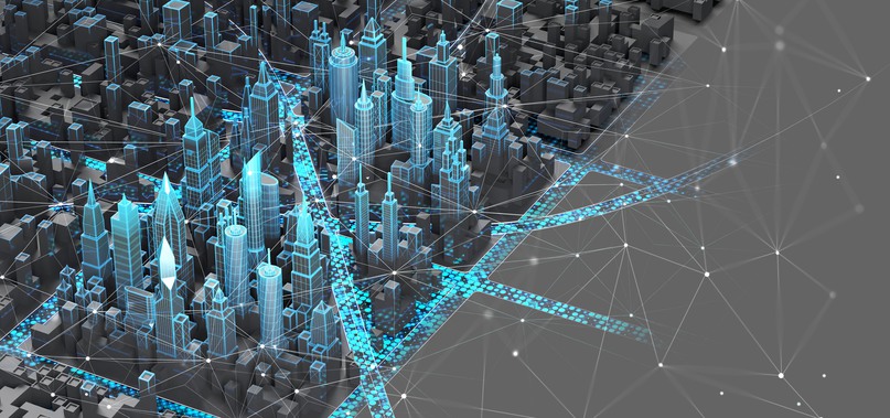
Signal processing enables smart cities and self-driving vehicles, the development of pacemakers and hearing aids, automatic image enhancement, mapping of the Earth’s surface, weather forecasts and climate models. Even the altitude variations on Venus have been mapped.
Mattias Dahl is a professor of systems engineering and Mats Pettersson is a professor of electrical engineering. Both work with systems engineering at BTH and with the adjacent subject of signal processing.
“Our partners can take measurements using radar and optic sensors from vehicles, satellites, drones and aeroplanes, for example. We receive data and build methods for generating images from the raw material, and for extracting specific information from it”, says Mats Pettersson.
Mattias Dahl adds that signal processing and BTH’s research are also central to the field of self-learning systems, i.e. artificial intelligence and its mathematics and statistics.
“Many of the analyses that artificial intelligence, AI, is able to do today have been made possible by signal processing research.”
Almost all progress in information technology includes the processing of information from sensors to humans.
“From a stream of information, you want to extract what is relevant to the context. Get rid of the noise and excess while highlighting the desired data. Signal processing now enables us to do this in much higher resolution and in increasing depth”, says Mattias Dahl.
Hearts and weather
Increased processing power and bandwidth generate many new applications within a broad spectrum, from vehicle engineering and industry to healthcare and energy technology.
“For example, it would be completely possible to measure the heartrate of the residents of a building with radar, instead of using surveillance cameras, which can violate personal integrity”, explains Mats Pettersson.
Weather forecasting is a major development area for applied signal processing. Another climate-related area that Mats Pettersson has been working with for a long time is enabling comparative studies of the ice cover in the Arctic.
Ports and vehicles
BTH was involved in a European project to map ports using radar measurements. Both smart ports and smart cities present many challenges involving signal processing.
“For a Swedish port, for example, we were tasked with monitoring vehicles over 24 hours on a large parking lot. The result enabled the area to be replanned and used more efficiently instead of being expanded”, says Mattias Dahl.
Mattias Dahl also mentions the measurement of vehicle movement on the Swedish road network. BTH was involved in developing a method for satellite measurement of large areas, using calculations to filter out vehicles of a certain size and to figure out average speed, length, etc.
Voyage of discovery on a new frequency band
With higher bandwidth in a new frequency area, the THz band, more details and other materials can be detected via 5G and 6G.
“For example, in the optical infrared frequency band, you can see in the dark and with x-rays you can see inside materials. Radar on terahertz frequencies has these properties but the band is relatively unexplored; we only partly know what we can see. We hope to be able to see properties that are important for the manufacturing industry, such as surface smoothness”, says Mats Pettersson.
Building transmitters and receivers for 5G and 6G is therefore extremely interesting for many more stakeholders beyond those in the telecom industry. To a great extent, research and development in signal processing entail making the most of increased possibilities and investigating what we can do with them.
“There are many new satellite systems around our planet and it is interesting to be involved in finding out what they can do and how their capacities can be utilised in various applications”, says Mats Pettersson.
Societal benefit
In collaboration with Region Blekinge, BTH has taken part in many society-related projects. Mathias Roos, who has worked on infrastructure issues in the region, explains that he was surprised by the great opportunities offered by collaboration with BTH. One of his questions was how radar data from satellites could contribute to following up regional decisions.
“In contacts with international colleagues, I noticed that everyone has the same need for deep and comparable analyses of long-term changes, so it was natural for us to involve BTH. There we found the combination of knowledge of proven radar technology and advanced methods for mathematical analysis”, says Mathias Roos.
He sees many applicable areas of analysis using radar measurements from satellites.
“It proved to be very efficient. In-depth comparisons of traffic flows before and after an investment, such as a double track on a railway line or a new stretch of road, provide clear and certain answers as to whether the aim was achieved”, says Mathias Roos.
10 March 2021